Gallery 4 - Mapping, geoprocessing, and other Web services.
The following screen captures show examples of integrating local data with Web mapping and other Web services via Web APIs. The descriptions include details on data sources and techniques used to create the images.
Click the thumbnail to view a larger image. All maps and images by: B. W.Szukalski.
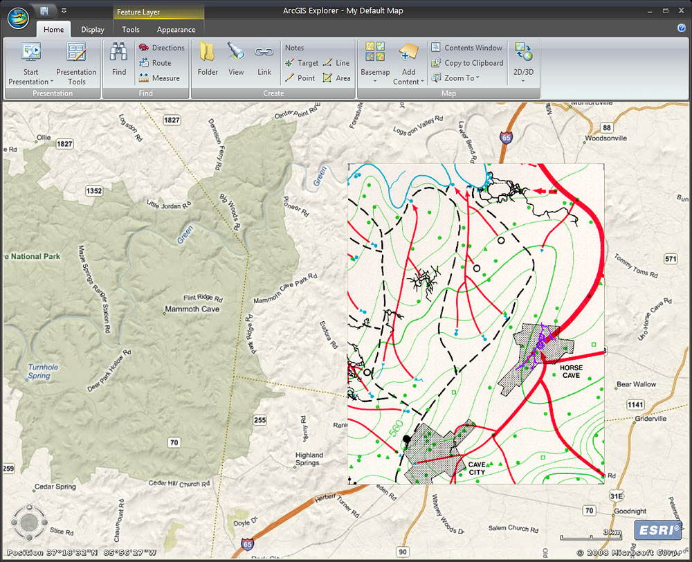
QUINLAN/RAY HYDRO MAP AND BING MAPS BASEMAP
A clipped portion of the scanned image of the Quinlan/Ray hydrologic map for the Mammoth Cave, Kentucky, region has been georeferenced using ArcGIS. The georeferenced image was drawn atop the the Microsoft Bing™ Maps for Enterprise (formerly known as Virtual Earth) streets basemap from ArcGIS Online. Other Bing Maps basemap services to choose from include hybrid and aerial basemaps. The transparency of the hydro map can be adjusted, and swipe can be used to slice the image to reveal the underlying basemap.
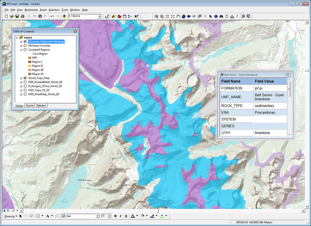
CARBONATE LITHOLOGY AND WORLD TOPO SERVICE
A reclassified (based on lithology) carbonate geology map of Montana authored as a layer package (LPK) using ArcGIS Desktop is shown atop a new World Topo basemap service published by ESRI on ArcGIS Online. The World Topo service is designed as an alternative to the standard USGS topo basemap service, and is cartographically designed specifically for basemap uses. The background is mostly white, and labels and other features are muted and designed to used along with other content. When authoring the LPK the HTML popup property was enabled, and reveals a style sheet controlled popup window when features are clicked. Only certain fields are displayed in the popup.
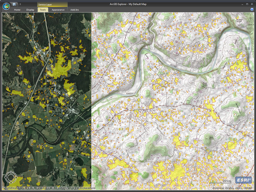
SINKHOLES WITH TOPO LAYER AND IMAGERY BASEMAP
Sinkholes in Hart County, Kentucky, were obtained from the Kentucky Geologic Survey. The sinkholes were drawn atop the default imagery basemap in ArcGIS Explorer. The USGS topographic map services from ArcGIS Online were added as a layer, and ordered so that the sinkholes would display on top. A swipe tool is being used to reveal the underlying imagery below the sinkholes and topographic map service. The map is viewed using ArcGIS Explorer.
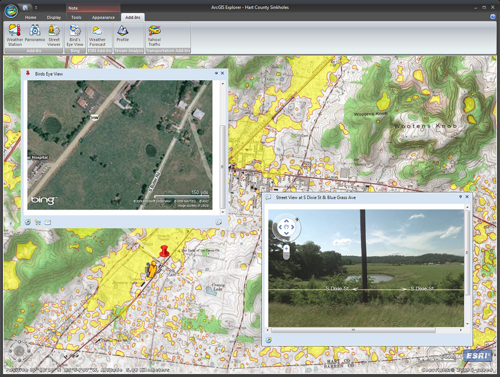
SINKHOLES WITH STREETVIEW AND BIRD'S EYE VIEW
The same data and services are used as above, but here we've added several custom add-ins to ArcGIS Explorer to extend its capabilities with other Web services. One add-in provides a popup window showing the Microsoft Bing Bird's Eye view of the area, and the other connects to the Google StreetView of the same area. The sinkholes can be seen on the map, and also visualized in the Bird's Eye and StreetView popups. This enables a virtual inspection of the actual karst features shown on the map.
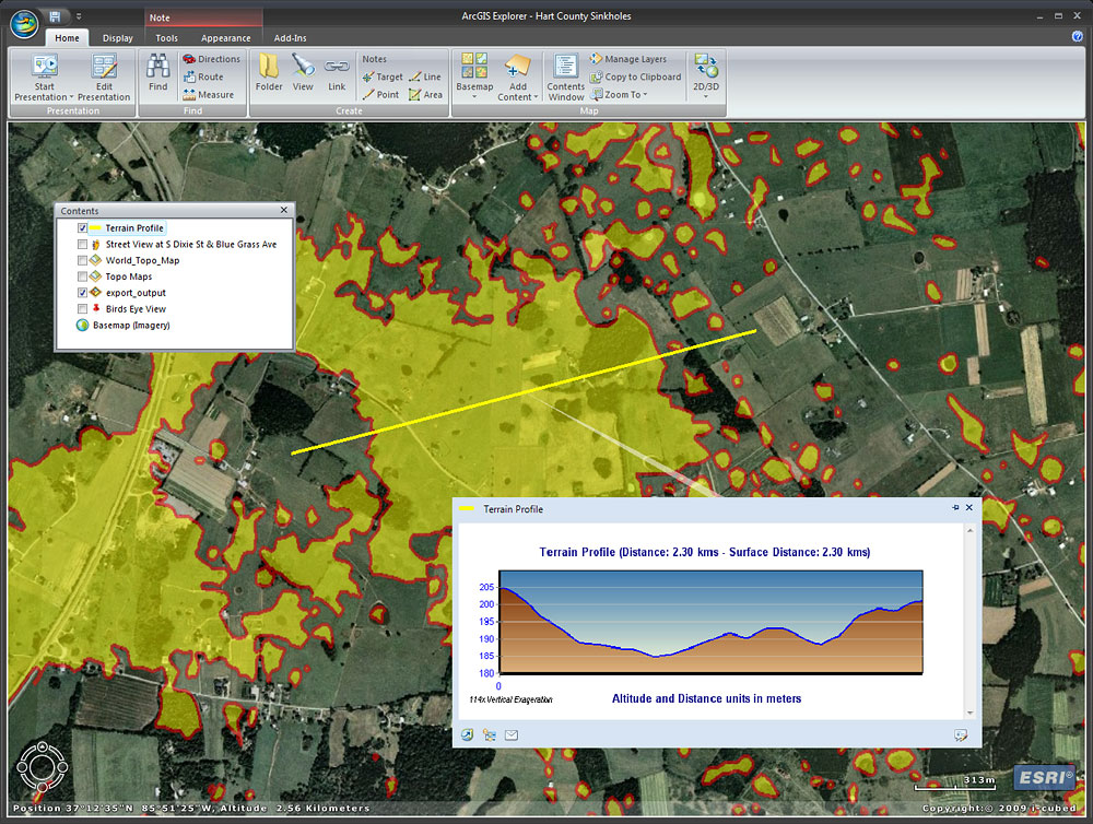
USING GEOPROCESSING SERVICES
Continuing building upon the two examples above, here a geoprocessing service is used to enable the user the ability to draw a line and view the cross-section profile along the line. The tool being used is a custom add-in that is communicating with an ArcGIS geoprocessing Web service. The geoprocessing tool was authored using ArcGIS Desktop, and published as a service using ArcGIS Server. The custom capability was added to ArcGIS Explorer as a custom add-in. Using ArcGIS Services even the free ArcGIS Explorer can be extended to perform GIS analysis.