Adding survey lineplots and passage wall models
Once you've gotten your cave locations, you may want add georeferenced cave survey data such as lineplots or passage outlines derived from measurements taken during the survey. Typically the cave entrance locations (obtained using a GPS position taken at one of the survey stations at or near the entrance) are used as the georeferencing point. Using Compass you can input the links from survey stations to actual geographic location to create shapefiles and KML exports of the survey data and cave passage models which can be viewed in a GIS.
This data can be used as the framework for adding vectorized or scanned maps if that's your ultimate goal, and can also be used to link to inventory data and other content. Here's an overview of some options to accomplish the basics of adding cave lineplots and passage outlines.
Click the thumbnail to view a larger image. All maps and images by: B. W. Szukalski.
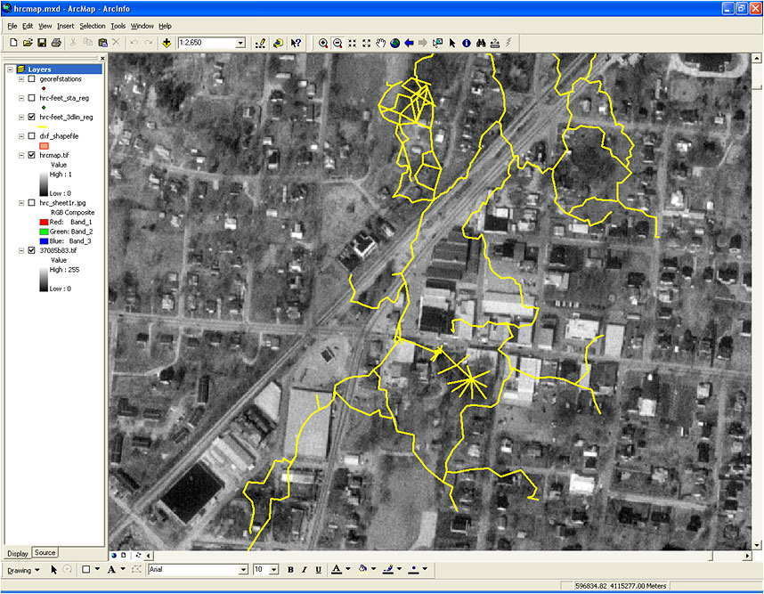
CAVE SURVEY LINE PLOTS
The cave survey data in this example has been exported as a shapefile from Compass, a popular and widely used cave survey program. The survey station link capabilities in Compass have been used to link survey stations to real world (GPS) coordinates, allowing a georeferenced shapefile to be exported. The survey lineplot is often used when georeferencing the final cave map.
This method is simple and easy, and provides an overall view of where the cave lies in relation to surface features. But only the survey lines are visibile, without the extra information provided by passage outlines. Passage outlines can be easily added prior to export from Compass, see the example below.
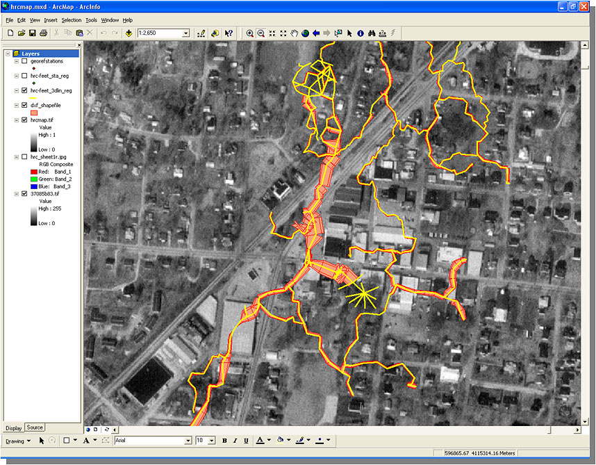
CAVE PASSAGE OUTLINES
Like the example above, the cave survey data has been exported as a shapefile using Compass. Compass provides a variety of passage wall modeling options based on the dimensions of the cave passage as measured during the survey. The modeled passages can be exported as shapefiles, KML, or DXF files for use in GIS and other software.
In this example the shapefile of the outline of the cave passage has been linked and exported from Compass, then added to the map . This method simple and easy, and provides the desired result of being able to visualize the cave passage in a GIS.
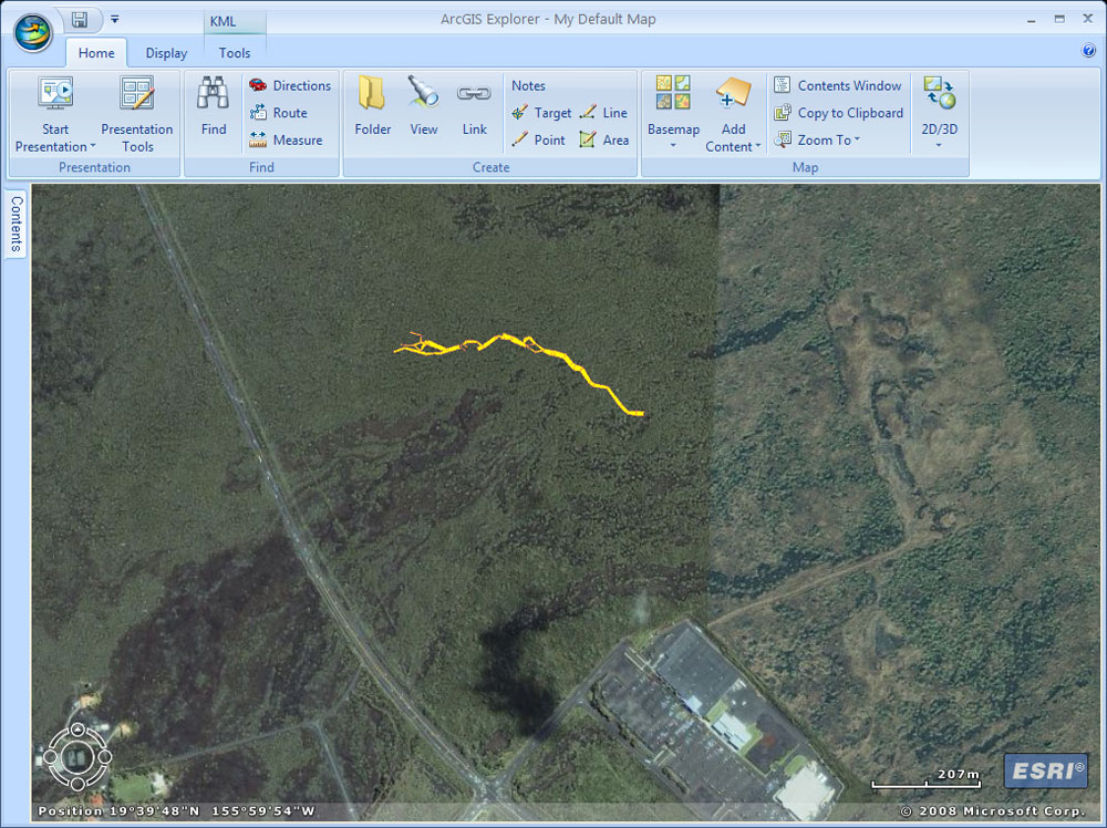
ARCGIS EXPLORER AND CAVE KML
One of the export options in Compass is KML, the format made ubiquitous by Google Earth. Here we've taken our cave survey data and modeled the passage walls using Compass, then exported the data to KML. Compass provides options for line and fill colors. The KML is shown here in ArcGIS Explorer, and the same file can be used in Google Earth.